Quick heads up: This post may contain affiliate links to gear, hotels, flights, or experiences I’ve used or genuinely recommend. If you book through one, I may earn a commission at no extra cost to you. Full disclosure here.
If you’re thinking about hiking Hallasan in South Korea, here’s what worked for me, what didn’t, and what I’d do differently if I were hiking it again.
Hiking Hallasan, South Korea’s tallest peak, is absolutely worth doing. If I could go back and hike it again, though, there are a few things I’d do differently.
I tackled the Seongpanak up, Gwaneumsa down route solo on a long, hot day in August, convinced that my Colorado legs and years of trekking in places like Nepal, Southeast Asia, and South America had me covered. They didn’t.
Between the humidity, a late start, and a long, punishing descent on already cranky knees, Hallasan was a humbling reminder that even a “day hike” can push you to your limits if you don’t go in prepared.
This is what the climb felt like, why the descent nearly broke me, and what I would do differently next time, from permits and route choices to timing, packing, and a few mistakes I would not repeat.
If you’re thinking about hiking Hallasan yourself, I hope this gives you a clearer picture of what to expect and helps you avoid some of the missteps I made.

🏔️ From Vail to Hallasan: My Solo Attempt to Tame Korea’s Highest Peak
If that intro didn’t exactly make you want to sprint to Jeju and book a summit permit, hang tight. My outlook gets a lot rosier from here.
But first, some honesty: Hallasan humbled me.
My wife filmed a quick clip right after I finished the hike, and it pretty much says everything. It was around 8 p.m. I had been on the trail for 10 hours, covered 11.4 miles (18.4 km), and logged more than 37,000 steps according to my iPhone. When she asked how it went, this was all I could muster:
🎥 Watch: My Hallasan Reaction Right After the Hike
Not exactly the triumphant mountaintop speech I imagined, but to be fair, most of the hike was actually great. I was smiling for much of the day, even if I was drenched in sweat from the moment I left the trailhead.
I’m sharing this so you can prepare better than I did and avoid ending your day begging for a sip of water before the camera can even be turned off.
So how did I get to that point?
I grew up in Vail, Colorado, at 8,250 feet, and I was hiking the Rockies before I could spell my own name. I’ve trekked the Kalalau Trail in Hawaii, the Annapurna Circuit in Nepal, the W Trek in Patagonia, and stood on top of Mount Kinabalu in Borneo.
I didn’t show up to Hallasan overconfident, but I definitely wasn’t expecting to limp into the Gwaneumsa parking lot feeling like I’d been chewed up and spit out by a volcano.
Unfortunately, time catches up with everyone.
After four decades of mountain sports and hard skiing, my knees have entered what I’d politely call their golden years. They feel fine on the way up, but the moment I start descending, they remind me how many miles are on the odometer.
Most days, that reminder is just a twinge. Push a little farther and it becomes a protest.
By the end of my Hallasan hike, though, my knees and feet were ready for a full-on strike. The Gwaneumsa descent was where those negotiations finally collapsed.
This has only become an issue in recent years, and one I’ve usually managed with cheap neoprene braces and some stubborn Gen X grit. That may sound like toughness in hindsight, but as I limped out into the parking lot at dusk, the sun had set on my pride as well.
The Gwaneumsa descent is more than five miles of slick volcanic rock and endless stairs. Add 90-degree heat, heavy humidity, and a late start, and the whole thing turned into a battle of attrition. I had read other bloggers warn about the difficulty, but I figured they were either out of shape or exaggerating.
Turns out they weren’t.


But let me be clear: I am not here to scare you away from hiking Hallasan. I actually loved most of it. Think of this as a handful of cautionary notes from someone whose heart still feels young, even if his knees have decided to file for early retirement.
If you are in your twenties or in excellent shape, you will probably cruise through this trail. If you are closer to my age or more accustomed to crisp Colorado air than subtropical humidity, do not underestimate this mountain.
It is a beautiful and rewarding climb, but it can punish poor planning.
I am glad I did it. But if I had a do-over, there are plenty of things I would change.
🥾 Seongpanak Up, Gwaneumsa Down: My Honest Take on Hallasan’s Most Popular Route
Before the hike, I chose the classic combo: up Seongpanak and down Gwaneumsa. It is the most common full traverse of Hallasan, and I figured it would give me the complete experience. Two trails, one summit, and one big check off the Korea adventure list.
That logic was not wrong. I did get to see both sides of the mountain, and sitting here now with a functioning keyboard and no volcanic rock under my feet, I am glad I experienced the full loop.
Here is the honest part. If I had gone up Seongpanak and returned the same way, I do not think I would have missed much in terms of scenery. I also would have arrived back at the trailhead in a far better state of mind and body than what you saw in that video clip above.
Unless you are in solid shape and confident your knees and ankles can take a sustained pounding, you might want to reconsider the full traverse or at least think about reversing it.
Here is how both sides stack up.
Seongpanak Trail Review: A Manageable Ascent to Hallasan’s Summit
Seongpanak was completely fine. Long, but steady and predictable. The climb is gradual, the footing is good, and most of the trail moves through shaded forest. There are a few stretches of stairs and some rocky patches, but nothing that should surprise anyone with basic hiking experience.
Much of the trail is covered with that rope-mat material you see on many Korean paths. It softens the impact and makes the miles pass more comfortably. The tree cover helps keep things cooler, at least compared to the exposed sections near the top. The first half will not win any awards for dramatic scenery, but it is gentle on the legs and easy to follow.

With cooler weather, I might have even called it enjoyable. There are a few steeper pushes and some volcanic stones that gave me attitude later in the day, but overall it is a forgiving ascent.
▶️ Watch: Starting the Hallasan hike on Seongpanak — shaded forest, soft footing, and cautious optimism.
Once you break through the tree line, the final stretch to the summit ramps up. You will climb a series of wooden staircases and a few short sections with ropes anchored into the rocks. Nothing technical, but enough to make you pay attention. Kids and older hikers were moving through this section at a steady pace on my hike.
One important note. You can only continue to the summit if you reach the Jindallaebat Shelter checkpoint by the cutoff time, which is usually around 12:30 p.m. Rangers take this seriously.
At the time, the rules felt strict, but after seeing the clouds roll in and dealing with the descent that followed, I fully understand why that cutoff exists.

And now, the descent…
Gwaneumsa Trail Descent: Scenic, Steep, and Tough on the Knees
By now you already know how my Gwaneumsa descent ended, so let’s start with the positives. Compared to Seongpanak, the views on the Gwaneumsa side are wider and more dramatic. You spend more time on open ridgelines and in exposed valleys, which gives you a real sense of being high on a volcanic mountain instead of tucked inside a forest. It is easily the more scenic side of Hallasan.
The wooden stair network is also impressive. The park service built a long series of steps that climbs almost all the way to the summit. The craftsmanship is solid, and at first I was genuinely impressed by how well the structure held up.

Eventually the stairs lose their charm. They continue for a very long time, and somewhere around the hundredth step my knees began to push back. Once that started, every landing felt worse than the last. If you prefer natural dirt trails and gradual switchbacks, this route can feel relentless.
When the stairs end, the terrain shifts into long stretches of jagged volcanic rock. Even with good hiking boots, the impact adds up quickly. I stopped several times just to take pressure off my feet, not because of blisters but because the pounding became exhausting.


Light rain started to fall during the lower section. The rocks turned slick, and the fading daylight made each step slower and more deliberate. At that point my focus shifted from finishing quickly to simply staying upright.
And it was not just me. I passed several younger hikers who were also struggling. One group included a guy who was moving well, but his mother was clearly in pain. Another family had a daughter who could not continue on her own, so her father carried her. By the time we all reached the bottom, everyone looked equally worn down.
That is when it became clear that this was not only about age or knee issues. The trail itself is demanding, and the descent punishes anyone who arrives tired or dehydrated.
Gwaneumsa is beautiful and memorable, but it is also steep, rocky, and very unforgiving.
If I had a second chance, I would go up and down Seongpanak. You still reach the summit and get all the big views, and the overall experience is much easier on your body.
Some hikers prefer ascending Gwaneumsa and descending Seongpanak, and that probably would have suited me better than the direction I chose. Even so, I still would not call that full route enjoyable, because you would be climbing every one of those stair sections that felt daunting enough on the way down.
For most people, especially anyone over thirty-five or dealing with a bit of wear and tear, I think Seongpanak both ways is the smarter and more pleasant choice.
Worried about missing the views on the Gwaneumsa side?
If you reach the summit with time to spare before the descent cutoff, you can hike partway down the Gwaneumsa trail for fifteen to thirty minutes, enjoy the best scenery, and then turn around and descend Seongpanak.
That gives you the highlights without the prolonged punishment.
🧭 What I’d Do Differently Next Time (If There Is One)
Even though I am not in a hurry to hike Hallasan again, there are a few things I would absolutely change if I ever decide to give it another shot. If you are planning your own climb, this list should help you avoid the mistakes I made and finish the day in a better state than I did.
1. Start Earlier
Early mornings are not my strong suit, and my wife moves even slower than I do. I am usually awake early, but I like to take my time with a few cups of coffee before heading out. I convinced myself I was fit enough to start later than recommended and still finish comfortably, which turned out to be wishful thinking.
Most hikers begin between 5 a.m. and 8 a.m. I did not hit the trail until 9.
I technically made all the cutoffs, but I reached the Gwaneumsa parking lot in the dark and drizzle, and the final stretch over slick volcanic rock was far more stressful than it needed to be. Once daylight fades, the margin for error disappears quickly. Start early and avoid the race against sunset.


2. Hike With a Partner
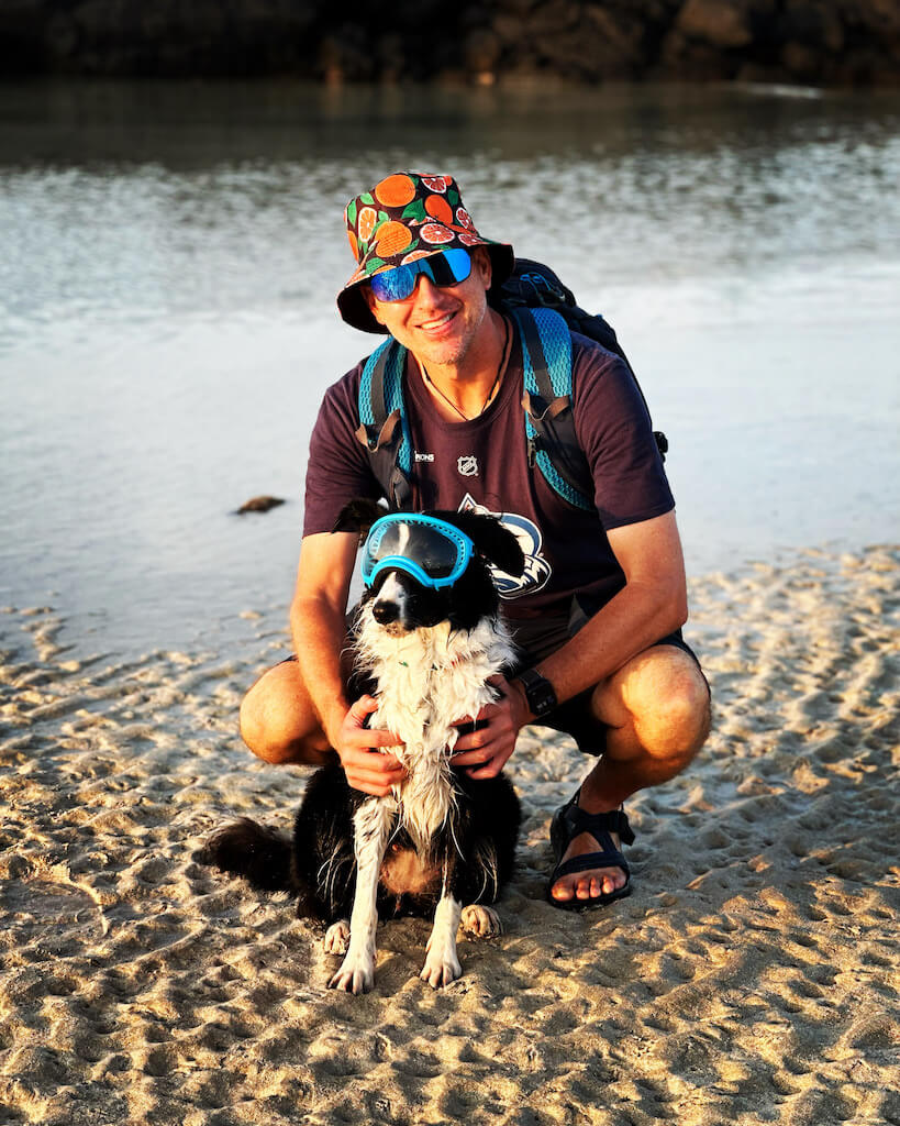
I normally enjoy hiking alone. My wife is not a hiker, and dogs are not allowed on Hallasan, so I set off solo while she and our dog enjoyed Jeju at sea level. For most of the day, I appreciated the quiet and the freedom to move at my own pace.
Later, when the rain started and my knees were starting to buckle, I would have welcomed a hiking buddy. Someone to keep spirits up or simply share the misery. Hallasan is a safe mountain, but when you are tired and the weather turns, having another person helps more than you think.
3. Avoid Summer
This one is simple. I do poorly in heat and humidity, and Hallasan in August felt like hiking inside a sauna. Even at higher elevations, there was almost no relief.
If you struggle in hot weather, skip June through early September. My shirts were soaked within the first hour and stayed that way all day, and by afternoon the humidity felt heavier than the climb itself. Bring extra dry layers if you insist on a summer hike, but honestly, choose a different season.
Best months: late October through early December, or April through early May.

4. Bring Better Food
The night before the hike, I grabbed the classic Korean convenience store spread: packaged sausages, chips, cookies, and a couple of Snickers bars. It was fine at the summit, but by the time I was halfway down Gwaneumsa, I was regretting my choices. The sodium, the aftertaste, the heat, the humidity… it was not a great combination.
A better approach is simple: bring real food.
📌 Korean Trekker’s Tip: Grab a big tuna gimbap (참치김밥) or an egg salad sandwich from the convenience store fridge section.


5. Pack More Water
I carried three one-liter bottles and figured I was being overly cautious. And yes, that’s as heavy as it sounds. But by the final stretch, I was rationing the last few sips like Tom Hanks in Castaway, and still had over an hour to go.
In hindsight, I probably shouldn’t have treated myself to those early, luxurious face showers, assuming I had water to spare or that I’d run into refill spots along the way.
At one point, I even gave a good portion of one bottle to a guy who had brought only a single bicycle-sized bottle. I never saw him again after that, but I really hope he turned back. We were only a few hours in.
If you’re hiking Hallasan, especially in summer: bring more water than you think you need. Then bring a little more.


6. Use Trekking Poles
For years, I dismissed trekking poles as overkill, but after Hallasan, I have joined the club. Poles take pressure off the knees, especially on steep and uneven descents, and I wish I had used them here. Anyone with aging joints will feel the difference.
7. Carry a Phone Battery Pack
By the time I was halfway through Gwaneumsa, my phone battery was nearly dead. Filming videos, taking photos, using AllTrails, and listening to podcasts drained it faster than expected. If my phone had shut off before reaching the bottom, meeting my wife would have been much harder. Bring a power bank, even a small one.
8. Skip the Ego Route
If I could redo the hike, I would go up and down Seongpanak. You still reach the summit and get great scenery, and your knees will thank you. The full traverse sounds impressive, but most people do not need it. Save your legs for a beach walk or another hike the next day.

🎟️ How to Hike Hallasan: Permits, Trailheads, and Timing
If you want to summit Hallasan, there are a few things you must sort out ahead of time: permits, timing, and how you plan to get to and from the trailheads. The trails themselves are well marked and straightforward, but the logistics can catch people by surprise. Here is what you need to know before you lace up.
📝 Reserving Your Hallasan Summit Permit
You cannot summit Hallasan without a reservation. Both Seongpanak and Gwaneumsa require permits, and there are no walk-in spots during peak seasons.
✅ Where to reserve:
Visit: https://visithalla.jeju.go.kr/main/main.do
(There is an English toggle in the top right corner.)
✅ What you’ll need:
- Choose Seongpanak or Gwaneumsa
- Pick your date and time slot
- Enter your group size
- Verify your ID by email or Kakao
- Save the QR code
Rangers scanned my QR code only once at the entrance, but I carried a printed copy just in case. It is worth doing the same.
⏰ Summit Cutoff Times
Hallasan has strict checkpoint deadlines to prevent hikers from getting stuck on the mountain in storms or in the dark. These times shift slightly by season, but the general rule is:
- 🕦 Seongpanak ascent: Reach Jindallaebat Shelter by ~12:30 p.m.
- 🕛 Gwaneumsa ascent: Reach Samgakbong Shelter by ~12:00 p.m.
If you miss the cutoff, you must turn back. There are no exceptions, even if the weather is perfect. After my descent experience, I fully understand why the rangers enforce it.
Descending does not require checkpoints, but finishing late in the day creates its own problems. I was pushing daylight by the time I reached the bottom, and it made an already long descent even more stressful.
🥾 Trail Overview (Quick Version)
⛺ Seongpanak Trail
- 9.6 km (6 miles) one way
- Gradual incline on a well-maintained forest path
- Summit access with permit
- The best choice for most hikers
⛺ Gwaneumsa Trail
- 8.7 km (5.4 miles) one way
- Steeper, more scenic, and much harder on the knees
- No summit access unless you reach it by descending after a Seongpanak ascent
- Rugged volcanic rock near the bottom
Navigation is simple on either trail. Signage is frequent and clear, and rangers are posted at key points. As long as you stay on the official path, it is hard to get lost.
🚐 Getting to the Trailheads
The trailheads sit on opposite sides of Hallasan and are not connected by public transport. They are about 45 minutes apart by car.
You can reach them by bus, taxi, or shuttle, but having your own car will make the entire experience far easier.
🚗 Best Option: Rent a Car
If your budget allows, renting a car is the smoothest way to tackle Hallasan and explore the rest of Jeju. Both trailheads have parking, and it gives you full control over your schedule.
A couple of quick notes:
- Dogs are not allowed on the summit trails.
- Most Korean rental companies allow pets inside the vehicle with a crate.
- If you are doing a point-to-point hike, you will need someone to drop you off and pick you up. My wife did this for me, which worked perfectly.
Search Jeju rental deals:
Dealing with Korean rental agencies can feel daunting, so booking through DiscoverCars is what I recommend.
🚌 Public Bus
You can reach both trailheads by bus, but it takes more time and offers little flexibility. If I had needed to catch a bus after the Gwaneumsa descent, I might still be sitting on a volcanic rock somewhere.
To Seongpanak:
- Bus 181 from Jeju Airport or Jeju City Hall
- Get off at Seongpanak Entrance
- Runs every 20 to 30 minutes
- Takes about 40 minutes
To Gwaneumsa:
- Bus 475 from Jeju National University
- Get off at Gwaneumsa Entrance
- Walk uphill about 1.5 km to the trailhead
- Runs every 60 to 90 minutes
🟡 Important: Return trips are the real challenge. If you finish late or miss a bus, you may be waiting a long time.Have a backup taxi app (like KakaoTaxi) just in case.
🚐 Shuttle Transfers
If you do not want to rent a car but want simpler logistics, a one-way or round-trip shuttle is a solid middle ground. These are especially useful for solo hikers.
- Choose a one-way or round-trip shuttle to Seongpanak or Gwaneumsa
- Makes back-and-forth logistics easy, especially if you’re doing the full traverse
- Book in advance to secure your pickup time
👉 Reserve a Hallasan shuttle transfer on Viator here
🗺️ Not Hiking the Summit?
Hallasan National Park has several shorter trails that do not require a permit.
If the full-day summit sounds too intense or you are short on time, these are great alternatives.
- Hallasan National Park has shorter, more accessible trails (like the Eoseungsaengak Trail) that offer great views without a permit.
- Scenic viewpoints and coastal drives can give you dramatic glimpses of the mountain without committing to a full-day trek.
👉 Book the Jeju Southern Euphoria Tour via Klook here
These kinds of tours are ideal for families, off-season travelers, or anyone wanting to experience Jeju’s nature without the elevation gain.
🧳 What to Pack for Hallasan (Especially in Summer)
Hallasan is a well-maintained trail, but it is not a casual walk. Summer heat, humidity, and constant elevation gain can wear you down fast. There are no places to buy food or water on the trail, aside from one spring near the bottom, so what you bring is what you have for the entire day.
Here is what I recommend based on what actually helped me, and what I wish I had packed.
🥤 Water
Bring at least 3 liters if you are hiking in summer. It is heavy, but running out is far worse.
🦯 Trekking Poles
I was late to the trekking-pole party, but they make a huge difference on steep descents, especially on Gwaneumsa’s stairs and volcanic rock.
💧 Electrolytes
Packets or tablets make a noticeable difference in hot, humid conditions. They helped me more than I expected.
🥾 Good Hiking Shoes
High-grip, trail-ready soles matter here. The volcanic rock on the Gwaneumsa side can be slick even when dry.
👕 Extra Layers
Bring a spare shirt, socks, and a towel. I went through everything I packed and wished I had one more dry layer.
🧢 Sun Protection
A hat and a small towel for wiping sweat are essential in summer. Jeju humidity feels relentless from the first hour.
🍙 Food
Pack real fuel, not just snacks. Gimbap, protein bars, fruit, nuts, or simple sandwiches work well.
My last-minute combination of sausages and Doritos was… not my finest trail choice.
📄 Permit Confirmation
Keep a digital and printed copy of your QR code. Rangers usually scan the digital version, but it is good to have both.
🗺️ Offline Maps
AllTrails, Google Maps (offline), or any app you trust. Coverage is generally good, but there are a few dead pockets near the top.
🔋 Battery Pack
My phone almost died near the bottom of Gwaneumsa, which would have made meeting my wife at pickup stressful. Bring a small power bank.
🩹 First Aid Basics
A few bandages, blister tape, and any personal meds are enough. You do not need a full kit.
📷 Camera or Phone
Fully charged, with enough storage for videos and summit photos.
🎥 Mini Tripod or Selfie Stick
Optional, but helpful if you like filming on the trail.
🧼 Hand Wipes or Sanitizer
Facilities exist at checkpoints, but not all have running water.
🧴 Sunscreen and Bug Spray
Both are worth packing, especially in summer.
🧊 Cooling Towel (Summer Only)
If you sweat easily or struggle with humidity, this will feel like magic.
🧥 Light Jacket (Fall and Spring)
A windbreaker or fleece is enough for shoulder seasons. Weather changes quickly near the summit.
🏁 Final Thoughts: Hallasan Was Absolutely Worth It… Once
If I had written these final thoughts the day after the hike, I probably would have had a very different take. But time heals all wounds, and I can now say honestly that climbing Hallasan was worth it.
Standing on top of South Korea’s tallest peak felt different from other summits I’ve done. It isn’t the highest or the hardest, but it earns your respect in ways you don’t expect at first.
Hallasan looks gentle from a distance, yet the reality is far tougher. By the time I reached the Gwaneumsa parking lot, the mountain had taught me a memorable lesson about humidity, volcanic rock, and a bit of humility for a former Colorado kid with aging skier knees.
Would I hike it again?
Probably not. Certainly not in August, and definitely not down Gwaneumsa.
Would I recommend it?
Absolutely. With the right timing and better planning than I demonstrated, Hallasan is a fantastic day hike and one of the most memorable things you can do on Jeju.
Go early, pick the right trail, pack more water than you think you’ll need, and do not underestimate the descent. Those few choices alone would have made my final miles a lot more enjoyable.
It is a hike that earns your respect, whether you summit it once, train on it weekly, or simply admire it from afar while sipping iced coffee in Jeju City.
However you approach it, Hallasan deserves a place on any outdoor adventurer’s South Korea itinerary.

🙏 Support the Blog
This guide isn’t sponsored by any park, company, or tourism board. A few links on this page are affiliate links, which means I may earn a small commission if you book through them at no extra cost to you.
If this post helped you plan your hike or saved your knees from the fate mine endured, you can support the site through Buy Me a Coffee. Every bit genuinely helps me keep writing, traveling, and researching new trails across Asia.
❓ Hallasan Hiking FAQ
Do I need a permit to hike Hallasan?
Yes, you need a free online reservation to hike Hallasan’s summit trails (Seongpanak or Gwaneumsa). Reservations open 7 days in advance and can fill up during peak season. You’ll need to show your QR code at the trailhead.
Which trail is better for Hallasan — Seongpanak or Gwaneumsa?
Seongpanak is longer but has a more gradual incline, making it the more popular choice for both ascent and descent. Gwaneumsa is shorter and steeper, with more dramatic scenery — but it’s tough on the knees, especially going down.
How difficult is the Hallasan hike?
It’s a challenging full-day hike, especially if you do the full traverse. Expect 8 to 10 hours on the trail with steep sections, variable weather, and limited water access. It’s not a technical hike, but it does require stamina, good gear, and planning.
Can I hike Hallasan with a dog?
Dogs are not allowed on Hallasan’s summit trails (Seongpanak or Gwaneumsa), but you can explore lower-elevation trails and some park areas with leashed pets. Check signage and park rules before heading out.
What should I pack for hiking Hallasan?
Bring plenty of water, snacks, layers for changing weather, a headlamp, trekking poles (optional but helpful), and trail-ready shoes with good grip. Mobile data is useful for maps and weather — an eSIM like Airalo works well across Jeju.
How do I get to the Hallasan trailheads without a car?
Seongpanak is accessible by public bus from Jeju City. Gwaneumsa is harder to reach but can be accessed via taxi or private shuttle. If you’re short on time or plan to explore more of Jeju, renting a car is your best bet.
When is the best time to hike Hallasan?
Fall (September to November) is the most popular season for clear skies and cooler temps. Spring is also great for flowers and visibility. Summer can be hot and humid with afternoon storms, while winter hikes may require crampons and extra caution due to snow and ice.
Do I need to be super fit to hike Hallasan?
You don’t need to be an elite hiker, but a good base level of fitness helps. The full traverse is long and strenuous, especially if you’re not used to steep descents or variable weather. With the right pace, prep, and mindset, most active travelers can complete it in a day.
🎒 Need Help Planning Your Korea Trip?
If you’re not sure where to stay on Jeju, how early to start, whether renting a car makes sense, or which trail fits your fitness level, I offer free one-on-one help for travelers.
This isn’t a travel agency. It’s just me using nearly twenty years of Asia travel experience to help people build trips that actually work in real life.
👉 Request free Korea trip help →
🌋 Jeju Travel Toolkit: Where to Stay, How to Get Around & What to Book
Whether Hallasan is your main goal or just one part of a longer Jeju itinerary, this pulls together the essentials without unnecessary clutter. These are the services I have personally used or researched thoroughly, and the platforms I find easiest for travelers.
✈️ Flights to Jeju
Most visitors fly into Jeju International Airport (CJU). It is quick, affordable, and well connected to the mainland.
🛏 Where to Stay on Jeju
The best base depends on your plans. Here are the three areas I recommend most:
Jeju City
Closest to the airport and public transport. Good for early trail starts and convenience.
Seogwipo
Great if you plan to explore waterfalls, coastal walks, and cafés. Slower pace and good for couples or families.
East Jeju (Songdang and nearby villages)
Quiet, peaceful areas with easy access to sunrise spots and eastern attractions.
Where to book:
- Agoda for Korea hotel deals
- Booking.com for all-in-one bookings and price comparisons
- VRBO for private, pet-friendly stays

In Korea, I usually start my search on Agoda:
🎟 Easy Activities and Tours on Jeju
Not every day on Jeju needs to be an epic summit or sunrise hike. If you’re looking for something lighter — or just want someone else to handle the logistics for a day — there are plenty of tours worth checking out.
From lava tubes to tea fields to waterfall walks, GetYourGuide has a solid range of easy day tours and small-group experiences across the island.
If you don’t find quite what you’re looking for there, Viator also offers a wider range of options including airport transfers, cultural tours, and more guided hikes.
🚗 Renting a Car on Jeju
For Hallasan hikers, renting a car is the best choice. Buses are fine for sightseeing, but after a long descent you will want direct transportation, not a long wait at a rural bus stop.
👉 How to drive in Korea as a foreigner →
You will need an International Driving Permit (IDP) unless you already have a Korean license.
📶 Staying Connected on Jeju
If you are visiting Korea from abroad, you will want reliable data for taxi apps, offline maps, and trail conditions.
I recommend:
- Airalo eSIMs for fast setup and good coverage across the island
👉 Get your Korea eSIM through Airalo →
🛡 Travel Insurance for Jeju and Hallasan
Hallasan is well maintained, but it is still a real mountain with steep sections and fast-shifting weather. Travel insurance is a smart addition to your trip planning.
I use SafetyWing because it is affordable, works well for international travel, and covers emergency medical treatment, trip delays, and gear issues.
If you’re looking for a deeper dive into where to go and what to do across the island, check out my full Dog-Friendly Jeju Road Trip Itinerary for beaches, cafes, and trails.

🛳️ Jeju Island Ferry
If you prefer to bring your own car, are traveling with pets, or just want a slower and more scenic option, the ferry is a great alternative.
👉 Read My Jeju Ferry Travel Guide →
👉 Book Jeju ferry tickets on Klook →

🧗 Adventure Apparel Inspired by My Trips Across Asia
I started designing travel and outdoor apparel for a simple reason. On so many trips, I came home wishing I had found something that actually captured the experience. A shirt that felt like a real memory, not a souvenir stand afterthought.
The designs in my store are inspired by the places I hike, ski, and explore across Asia, including Korea and Jeju. Everything is fulfilled by Printful, so the quality is solid, the prices stay reasonable, and these are items I actually wear myself.
If you want something meaningful to take home from your own adventures, or a gift for someone who loves the outdoors, you can browse the full collection here:
👉 Visit the Colorado Saram Store →


🥾 More Treks from Across Asia
If Hallasan got you dreaming of more big hikes, here are a few other routes I’ve tackled that might hit your radar:
- 🇻🇳 Sapa, Vietnam: Self-guided trekking through rice terraces, misty ridges, and welcoming hill tribe villages. Read my Sapa Trekking Guide
- 🇳🇵 Nepal: Choosing between the Annapurna Circuit and Everest Base Camp? I’ve done both. Here’s a full breakdown to help you decide. Annapurna vs. EBC Comparison
- 🇰🇷 Mainland South Korea: Daegwallyeong in Gangwon-do might be Korea’s most underrated mountain escape. Trekking & Camping in Daegwallyeong
Whether you’re craving culture, challenge, or just a good excuse to lace up the boots again, each of these hikes brought something different to the table.